The Aljama of Madinat al-Zahra

On the terrace located in the east of the “High Garden” of Medina Azahara, the Aljama Mosque was built, which, due to its location (next to the palace but outside it) allowed to share the use of the building among the population of the city and the inhabitants of the fortress. The date when the works finished varies: some written sources suggest the year 941, whereas the remains of a main commemorative plaque date it back to the year 944 or 945. There are barely any remains of the building, which suffered the pillaging of materials more severely. Well oriented towards Mecca (southeast), the floor of the Mosque is rectangular, and three of its main elements (courtyard, prayer hall and minaret) follow the “classical” scheme of other mosques in the Islamic West. The ablutions courtyard (sahn) has galleries covered on three of its sides, but not in the southest, occupied by the façade of the prayer hall, and it was paved with violet limestone tiles.

The prayer hall has a basilical floor, with five naves perpendicular to the wall of the qibla, which stands out because it corrected the diversions in the Aljama Mosque of Córdoba. These naves are separated by arcades consisting of eight horseshoe arches. The sandy floor covering the prayer hall (haram) was covered by straw mats, except in the macsura –elevated platform from where Caliph or Iman led the prayer–, which is paved with clay tiles. As for the mihrab, deep alcove facing the exterior, centre of every Mosque and where the richest and most attractive decoration is concentrated, there are barely any remains left that suggest its shape and decorative motifs.

From the “Rich Hall“, the Caliph could enter the prayer hall through a covered passageway (sabat) attached to the easter side of the “High Garden“. The gradient of the street was solved with a three-arched bridge, (which is preserved except for its base), built at the end of the mandate of Abderraman III or the beginning of that of his son Alhaken II.

On the northwestern side, next to the main door, the minaret is erected, a square tower in the exterior and octagonal inside, where there was a stairway climbing the terrace from where the muezzin summoned the believers to prayer. Its location, in the inside of the courtyard and moved from the central axis to form a line between the entrance door and the mihrab, anticipates the Aljama Mosque of Córdoba.

In front of the main façade of the Aljama Mosque of Medina Azahara they erected a series of rooms that have been identified as a “House of the Alms” (Dar al-sadaka), due to its distribution and location.

With the Mosque, we finish the analysis of the main buildings and remains located in the eastern part of the fortress, which we have called the “public” section. From now on, we will start the analysis of the western part, the “private section”. However, this division by functionality does not apply to all cases, as we will see that the “Courtyard of the Pillars” has a public or official character.

The roman city of “Corduba”

Corduba, that is, Roman Córdoba, was founded by General Claudio Marcelo between the years 169 BC and 152 BC, and he settled, as we will see in the section dedicated to urban planning, opposite the part of river Guadalquivir where it is no longer navigable. The settlement had an undoubtedly excellent strategic situation, as it was a platform through which the land could be accessed in times of conquest. During the first years, the Romans lived together with the native population that was already established in villages near the city, but they gradually disappeared.

The new city, located on the highest hill of the current city, was from the beginning capital of the province of the Hispania Ulterior (Hispania “The Far“), which shows the importance Córdoba has had since ancient times. As time went by, a new period of conflicts started in Rome, triggered by the civil wars between Caesar and Pompey’s sons, which finished with the end of the Roman Republic. The city supported Pompey, the losing side; therefore the reprisal soon arrived, and Córdoba, with more than 20,000 inhabitants at the time, was severely punished, and a long period of recession started.

With the arrival of Emperor Augustus to power, things started to change, as he settled in Roman Córdoba a great number of veterans who had taken part in the northern wars, and he gave them numerous portions of land. But the most important thing is that, at this time, and despite his political records, Augustus granted the city the status of Colonia Patricia, the highest rank a city of the Roman Empire could have (also Carthago Nova, Tarraco or Astigi had it in Hispania).

Along the 1st century AD, Corduba experienced numerous transformations caused by this change of status: the walled perimeter was extended until River Betis (current Guadalquivir) and an embellishment and monumental process started, imitating the models brought from Rome, such as the remodelling of the primitive forum, which was extended following the example of the Forum of Augustus in Rome. The Provincial Forum was also built, located in the Altos de Santa Ana, or the Port Centre, located in the vicinity of the Alcázar of the Christian Monarchs. The currently known as Roman Bridge was erected, entering the city from the south, or the first aqueduct, which guaranteed a permanent water supply.

Due to the close relationship between Corduba and the Emperor, it is not surprising that he was worshipped here from the beginning. The Temple on Claudio Marcelo Street proves this. The building of this complex, as a public square, which centralised official activities– according to Desiderio Vaquerizo– was conceived as a tribute for the Emperor and his family, and it was dedicated to his cult.

Together with the building of monuments and the improvement of the infrastructures, we need to add the great development of civil architecture, as many domus (houses) and insulae (blocks) appreared gathered in neighbourhoods. On the other hand, we cannot forget the monumental character of the funerary landscape, which, according to experts, could be compared to that of the capital of the Empire. Located along the first kilometres next to the roads leaving Roman Córdoba, the best preserved example is the Mausoleum of Puerta Gallegos, which will be explained in detail later on.

Corduba’s splendor continued until the first crisis of the 3rd century; new public buildings were no longer built, and they also stopped the supply of quality material, thus workshops were in crisis and, consequently, some spaces were reused and the houses became older due to the lack of new constructions. All this led to the loss of the capital status of the province.

This whole decadent scene was counteracted by the building of one of the greatest projects witnessed by the city, the Palace of Emperor Maximianus Herculeus. The palace was erected in order to accommodate the Emperor during his stay in Córdoba, who was in the middle of a pacifying campaign in the south of Hispania and the north of Africa.

Next, we have prepared a brief analysis of the urban evolution of the city. Shortly afterward, as we have done before, we have organized a short tour around the most significant monuments preserved.

Funerary Monuments of Puerta Gallegos

Some of the most significant examples of monumental funerary architecture in Roman Cordoba, for its size -13 meter diameter- and for the architectonic type in which they can be classified.

They are located on both sides of the Roman road connecting the city since Republican times, the so-called Corduba-Hispalis, on the right bank of the river Guadalquivir.

This road forked in two; one of them was old road to Almodovar, which was one of the most important burial areas in the city.

It was in Augustus’s times when the first funerary monument was built, consisting of anustrinum (where the cremation of the corpse was made) and an area of funerary placement separated from the former by a low wall, thus forming a complex that has interesting similarities to those of other cities in Betica, such as Baelo Claudia.

We should probably date in this time the paving of the road with puddingstone, now a clear extension of the main street in the city with an orientation east-west, the Decumanus Maximus. This must be understood taking into account the urban planning of the area, together with the building of a bridge and the embellishment of the gates of the city.

In times of Emperor Tiberio, this process of building monuments got to its peak with the construction of two cylindrical funerary monuments with identical size but different function.

The northern one, which has a better conservation state, was erected respecting the previous burial, which suggests a familiar relationship between the users of both complexes. It also maintains its individual character, whereas the southern one seems to have been conceived as a collective burial probably for the remains of the relatives of that buried in the first building.

As for its type, we can highlight its direct Italian tradition, although there are exact parallels in the funerary architecture in Hispania. Their shape resemble other monuments located in Carmona, Alcalá de Guadaira, Mérida and maybe Les Gunyoles (Tarragona).

The spreading of this kind of cylindrical monument can be explained through the importance of the mausoleum of Emperor Augustus himself.

The existence of these magnificent buildings is just another proof of the fact that Roman Cordoba was a clear reflection of the capital itself, Rome, in the middle of a process of ideological and iconographic transmission, which was unique in the rest of Hispania.

This type of building seems to be related to the ordo equester, one of the most important sectors of Roman society. We must also remember the privileged location of the funerary monuments, very close to the road, thus being part of the “image of the city”, which emphasizes the special importance they had in the society of Roman Córdoba.

The constructive techniques show the continuous use of traditional techniques in the Patrician architecture, such as the use of the opus quadratum or the “mine stone”, but at the same time, new trends in Roman architecture were imported, such as the opus caementicium and the massive use of marble.

Although it may be difficult to understand, the funerary monuments did not last long, as at the end of the 2nd century AD, the funerary area was literally invaded by domestic and commercial buildings that belonged to one of the neighbourhoods that had appeared outside the walls of the city while the road mentioned was removed and elevated.

Chefchaouen

Chefchaouen

Chefchaouen

Beautifully perched beneath the raw peaks of the Rif, Chefchaouen is one of the prettiest towns in Morocco, an artsy, blue-washed mountain village that feels like its own world. While tourism has definitely taken hold, the balance between ease and authenticity is just right. The old medina is a delight of Moroccan and Andalusian influence with red-tiled roofs, bright-blue buildings and narrow lanes converging on busy Plaza Uta El Hammam and its restored kasbah. Long known to backpackers for the easy availability of kif (cannabis), the town has rapidly gentrified and offers a range of quality accommodation, good food, lots to do and no hassles to speak of, making it a strong alternative to a hectic multicity tour. This is a great place to relax, explore and take day trips to the cool green hills.

Visigoth kingdom

Visigoth kingdom

Visigoth kingdom

One of the most important of the Germanic peoples, the Visigoths separated from the Ostrogoths in the 4th century AD, raided Roman territories repeatedly, and established great kingdoms in Gaul and Spain.

Roman power in Spain collapsed during the 5th century ce when a number of Germanic peoples—the Suebi, the Alani, the Vandals. The Visigoths were settled agriculturists in Dacia (now in Romania) when they were attacked by the Huns in 376 and driven southward across the Danube River into the Roman Empire. They were allowed to enter the empire but the exactions of Roman officials soon drove them to revolt and plunder the Balkan provinces, assisted by some Ostrogoths. On Aug. 9, 378, they utterly defeated the army of the Roman emperor Valens on the plains outside Adrianople, killing the emperor himself. For four more years they continued to wander in search of somewhere to settle. In October 382 Valens’ successor, Theodosius I, settled them in Moesia (in the Balkans) as federates, giving them land there and imposing on them the duty of defending the frontier. It was apparently during this period that the Visigoths were converted to Arian Christianity. They remained in Moesia until 395, when, under the leadership of Alaric, they left Moesia and moved first southward into Greece and then to Italy, which they invaded repeatedly from 401 onward. Their depredations culminated in the sack of Rome in 410. In the same year Alaric died and was succeeded by Ataulphus, who led the Visigoths to settle first in southern Gaul, then in Spain (415).

In 418 they were recalled from Spain by the patrician Constantius, who later became emperor as Constantius III, and were settled by him as federates in the province of Aquitania Secunda between the lower reaches of the Garonne and Loire rivers. Their chieftain Wallia died soon after the settlement in Aquitaine was carried out, and he was succeeded by Theodoric I, who ruled them until he was killed in 451 fighting against Attila in the Battle of the Catalaunian Plains. Theodoric I is the first Visigothic leader who can properly be described as a monarch.

While persistently trying to extend their territory, often at the empire’s expense, the Visigoths continued to be federates until 475, when Theodoric’s son Euric declared himself an independent king. Euric also codified the laws issued by himself and his predecessors and fragments of his code, written in Latin, have survived. It was under him, too, that the Gallic kingdom, of which the capital was at Toulouse, reached its widest extent. It stretched from the Loire to the Pyrenees and to the lower reaches of the Rhône River and included the greater portion of Spain. Euric, a fervent Arian, was succeeded by his tolerant son Alaric II, who in 507 was defeated and killed by Clovis and the Franks at the decisive battle of Vouillé near Poitiers.

As a result of Vouillé the Visigoths lost all their possessions in Gaul apart from Septimania, a strip of land stretching along the coast from the Pyrenees to the Rhône with Narbonne as its capital, which the Franks were never able to wrest from them. Henceforth, until they were finally destroyed by the Muslims in 711, the Visigoths ruled Septimania and much of Spain, with Toledo as their capital.

Thanks to The Editors of Encyclopaedia Britannica. Article was most recently revised and updated byAdam Augustyn

Choose Andalusia and get soaked the joy of southern Spain

Choose Andalusia and get soaked the joy of southern Spain

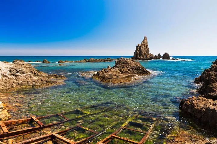
Costa de Almeria

The Costa de Almería is well known for its coves and almost virgin-like beaches where you can enjoy the sea in complete tranquillity. This is perhaps the sunniest area in Europe and it enjoys this condition for almost 95% of the year.

The environment of the Cabo de Gata-Níjar Natural Park has some of the best examples as well as volcanic landscapes of outstanding beauty.  Some good options from its towns and villages include Mojacar, with its picturesque outline of white houses), the fishing port of Carboneras and Roquetas de Mar for its long beaches.


Costa tropical

The Mediterranean continues in Andalusia towards Granada.  Here, more than 70 kilometres of coastline are known as the Tropical Coast because it has over 320 days a year of sun and average temperature of 20 degrees.

Its landscapes are formed with a combination of sea and mountains with rural areas of great interest such as the Sierra Nevada National Park or Las Alpujarras.

Motril, with its interesting old quarter, is the most highly populated town on the coast. Salobreña catches ones attention because its white houses sweep down a hill opposite the sea towards its Moorish castle. Almuñécar boasts large beaches lapped by turquoise water, which are protected by the mountains.

Costa del sol

Málaga and Marbella are the two largest international cities on the Costa del Sol. A paradise for golfers and a delight for their companions. Apart from the wide range of cultural, leisure and retail activities offered by the two large cities on this coastline, you can find squares and streets full of charm in places like Benalmádena, Mijas or Estepona. Pretty hidden gems with narrow streets running between white-washed houses adorned with flowers and small terraces where you can sit, relax and soak up the moment. And the nearest beach is never far away to enjoy the Mediterranean.

Costa de la luz

Next we come to the Costa de la luz, which extends between the provinces of Cádiz and Huelva. Its name (“Coast of Light”) is not by chance and responds to the area’s luminosity. There are over 200 kilometres of coastline in total with some of the very best beaches in Spain.

Cadiz
Cádiz is the country’s most southerly point and where the Mediterranean Sea meets the Atlantic Ocean. Here you can find pretty towns and villages with sea views at almost any point of the coast between San Roque and Sanlúcar de Barrameda. For example, Vejer de la Frontera is a maze of narrow streets dotted with white houses and fantastic viewpoints over the Mediterranean. Conil de la Frontera is a small, peaceful village located between extensive golden sand beaches. And places like Zahara de los Atunes or Caños de Meca are havens for unwinding.

Doñana National Park Huelvaa Andalusia Spain
Huelva

The long beaches continue in Huelva, with municipalities such as Punta Umbría and Islantilla, which are particularly family-oriented. This area is characterized by its marshlands and the presence of the Doñana National Park.

If you stay in municipalities such as Moguer, Palos de la Frontera or Ayamonte, you will be able to enjoy the extensive, peaceful almost virgin beaches in Torre del Loro, La Bota, Los Enebrales or Cuesta Maneli, among other places.

Doñana National Park

Doñana is one of Europe's most beautiful and important wetlands. What makes this national park, between the Andalusian provinces of Huelva, Seville, and Cadiz, so special is that in just one day you can see very different ecosystems: marshland, lagoons, pine groves, aloe veras, moving dunes, cliffs, 30 kilometers of unspoiled white beaches.
Flamenco Birds Doñana National Park Southern Spain Andalusia

Flavours of the Andalusian Coast

Good food is an essential ingredient of a few days of relaxation and in the south of Andalusia, you can find some really tasty dishes to enjoy at mealtime. There are famous dishes such as gazpacho or salmorejo (two cold soups featuring tomato as the main ingredient) and essential products like extra virgin olive oil or Iberian cured ham, but as this trip takes in the coast, here we highlight some of the region’s most popular fish and seafood products.

Some star dishes include the prawns from Huelva, pescaíto frito (fried fish), tuna from almadraba, typical above all in Cádiz, the espetos de sardinas (sardine skewers grilled on the beach) particularly popular in Málaga, the seafood soup in Almería (normally prepared with monkfish and shellfish), moraga de sardina (a typical sardine stew from Granada and Málaga) and the salted fish and seafood along the entire coast.